
CEDIM Risk Explorer Germany
The CEDIM Risk Explorer Germany (Müller et al., 2006) is a web-based map viewer that interactively presents the results of the CEDIM Research Focus Risk Map Germany. In 2021, the platform moved and was integrated into the CEDIM/Risklayer Explorer (Link).
 The CEDIM Risk Explorer Germany (
The CEDIM Risk Explorer Germany offers users the possibility to create maps of various datasets developed in this project, especially maps of hazard, vulnerability and risk related to natural disasters (earthquakes, winter storms). For Saxony, the analyses were also performed for floods.
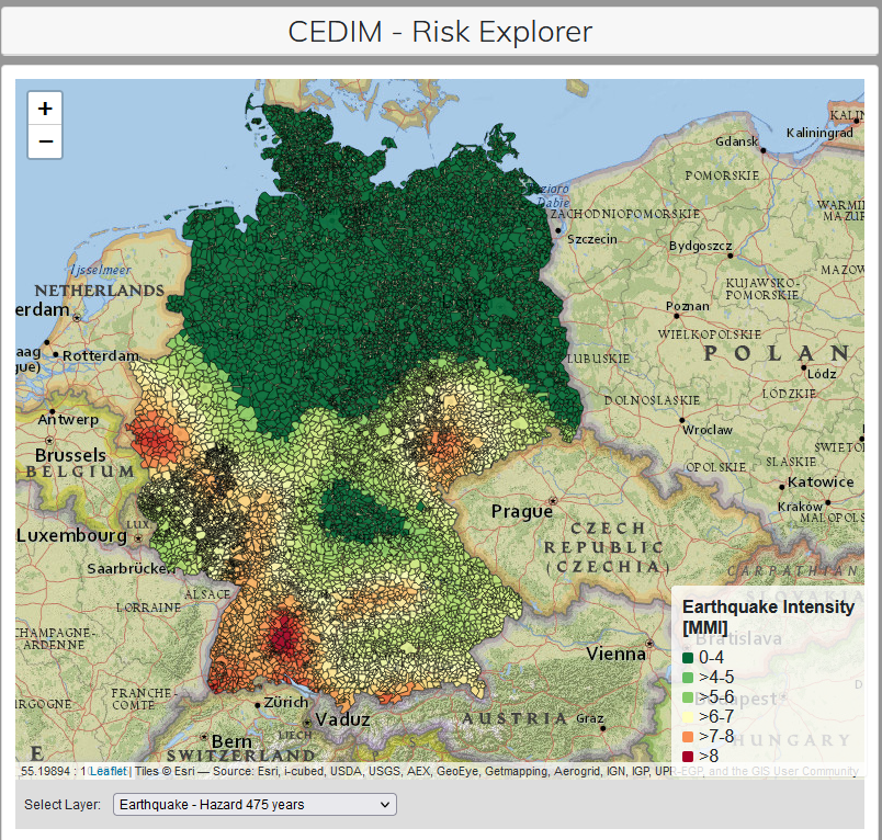
Hazard Maps
A hazard is a potentially damaging physical event, phenomenon and/or human activity, which may cause the loss of life or injury, property damage, social and economic disruption or environmental degradation. Within the CEDIM Riskmap Germany project, a hazard describes the probability of occurrence of a potentially destructive natural phenomenon in a defined area within a defined time period. For example, for earthquakes, the hazard map shows for each location the earthquake intensity that is expected to occur once in 500 years.
Vulnerability Maps
The vulnerability (or susceptibility) of a system (structure, plant or facility, country or state, company etc.) towards harmful outside influences. The vulnerability maps show the degree of loss resulting from a hazard as a percentage.
Risk Maps
In general terms, risk means the possibility of a loss resulting from exposure to a hazard. Risk is assessed by analyzing hazards and the associated vulnerability. Within the CEDIM Riskmap Germany project, risk is expressed in expected monetary losses from a certain disaster type for a certain time period (so far, only regarding dwelling assets). Risk maps show the spatial allocation of risk, i.e. the expected damage or monetary loss for a certain time period.
Asset Maps
Assets are entities functioning as stores of value, from which economic benefits may be derived by their owners by holding them, or using them, over a period of time. In the context of the CEDIM Riskmap Germany, assets represent the elements that are at risk from natural or man-made hazards. The asset maps present the disaggregated spatial distribution of these elements within Germany.
For questions and comments, please contact info∂cedim.de.
Related publication:
Müller, M., Vorogushyn, S., Maier, P., Thieken, A. H., Petrow, T., Kron, A., Büchele, B., and Wächter, J. (2006): CEDIM Risk Explorer – A map server solution in the project "Risk Map Germany", Nat. Hazards Earth Syst. Sci., 6, 711–720, doi:10.5194/nhess-6-711-2006.